
A Sapiens migration atlas · Reviewed 12 October 2026
The highways written in the sky.
A bird can cross an ocean without landing. Most journeys, though, depend on a chain of places where it can feed and rest. This is an atlas of both the flight and the ground beneath it.
The journey begins on the ground
Even a sky-wide journey needs somewhere to land.
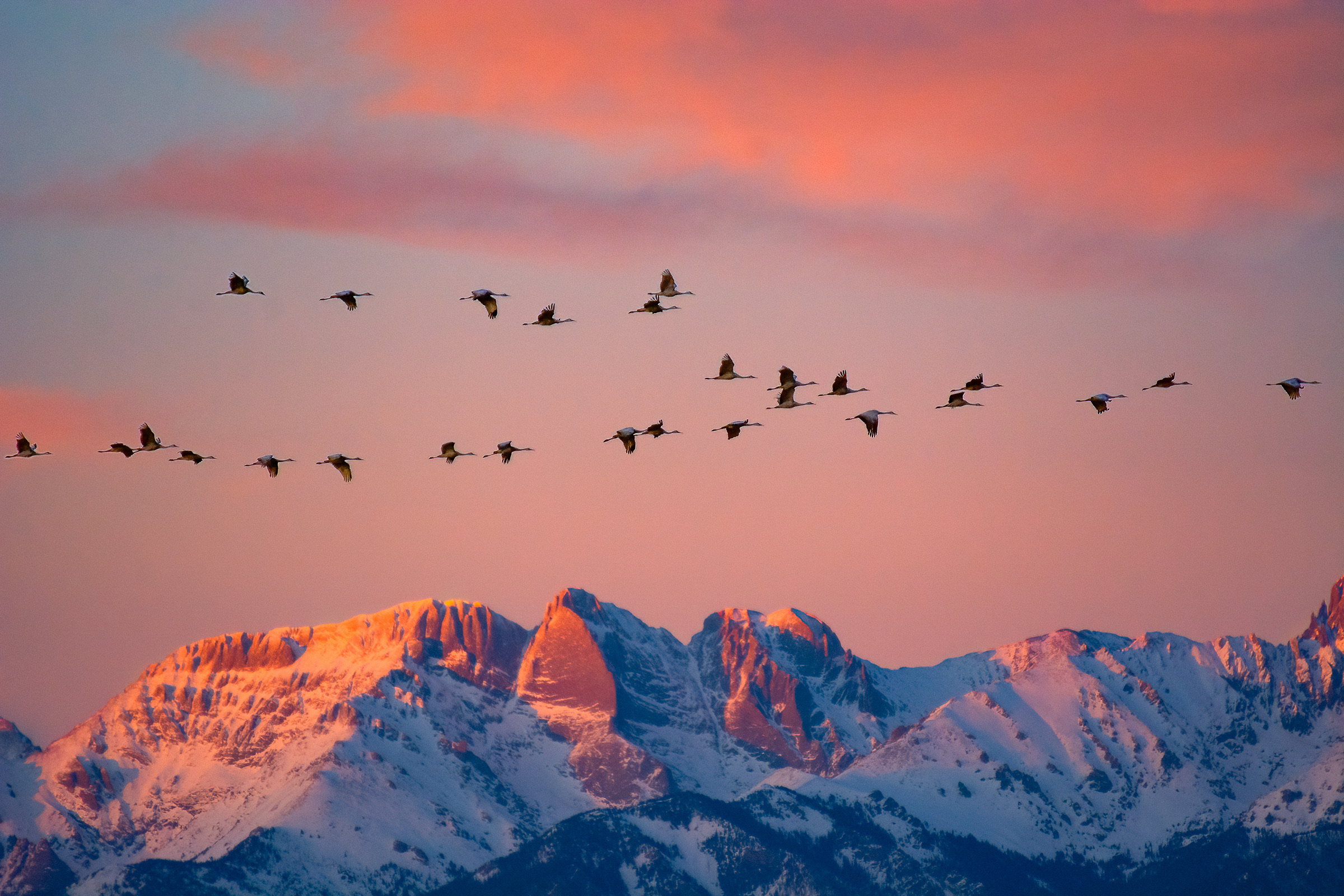
At dusk in Colorado's San Luis Valley, sandhill cranes leave the fields and make for the wetlands. The mountains turn pink behind them. More than 20,000 pass through this valley in parts of the spring and fall, building the energy they will need before continuing north or south.
What looks like one magnificent movement is made of many decisions: a safe place to sleep, enough food, favorable weather, and the next suitable shore. For most migratory birds, the route is only as dependable as those places along it.
The atlas
Four ways across a connected world.
BirdLife groups many overlapping land and coastal routes into four broad flyway systems. Choose one to trace its general reach. The lines show regions of movement, not the precise path of a particular bird.
01 · The long flight
One young godwit flew eleven days without landing.
In October 2022, a bar-tailed godwit tagged B6 left Alaska and reached Tasmania 11 days later. Its satellite transmitter recorded an 8,425-mile non-stop flight. It was the longest documented non-stop flight by any animal when the U.S. Geological Survey reported it. The bird was only months old.
That record is astonishing, but it starts in an ordinary-looking place: coastal feeding grounds where a bird can put on the fuel to leave at all. USGS scientists study those sites and the threats shorebirds face there, including habitat change and rising seas.

to Tasmania
8,425 miles. No landing. The route of one individual, not a typical distance for every godwit.
Read the USGS account02 · Two summers
For an Arctic tern, summer can happen twice in one year.
The Arctic tern nests in the far north, then travels toward Antarctic waters for the southern summer. Cornell Lab of Ornithology estimates that North American birds can cover around 25,000 miles in a year. Their route is shaped by coastlines, winds and the sea; it is not a straight line drawn between poles.
The species makes distance feel almost effortless from the ground. It is not. A small bird must feed, avoid storms and return to a place where nesting still works the following year. Protecting migration means looking beyond a breeding site or a single national boundary.
03 · The places between
A wetland can matter as much as a destination.
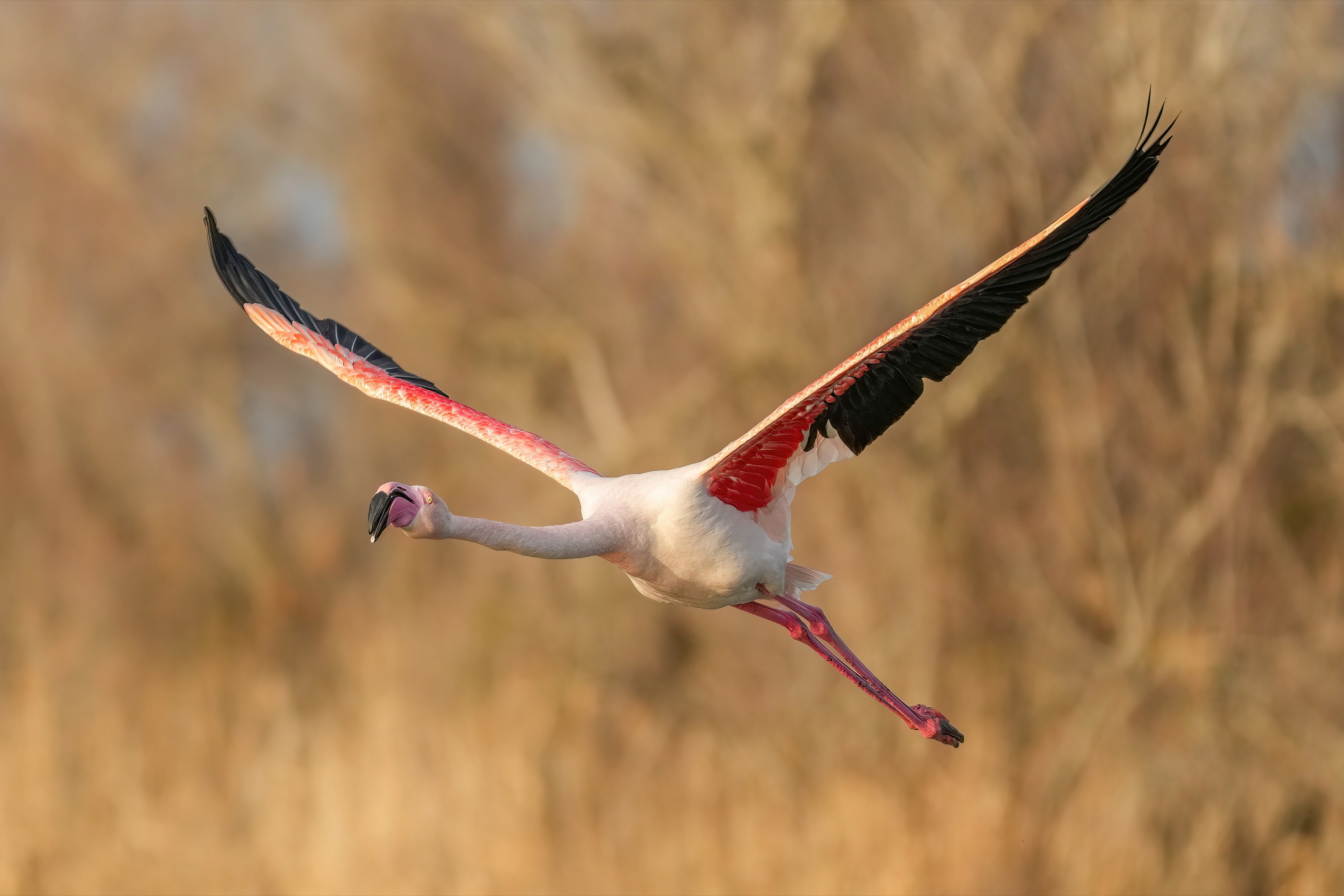
On the East Asian–Australasian Flyway, more than 50 million migratory waterbirds rely on a chain that runs from Arctic tundra to tropical wetlands and southern coasts. Mudflats, marshes and mangroves may look like small pauses on a map. For birds arriving hungry, they are working habitat.
BirdLife describes conservation work with local partners across 37 countries. At Pak Thale in Thailand, for example, community groups work to protect migratory birds and support sustainable livelihoods around the wetlands. No one government can secure an entire flyway. The places have to remain connected.
The 2026 update from the UN Environment Programme's conservation monitoring centre found that 49% of migratory animal species listed under the global convention were declining. That figure covers birds and other migratory animals; it is not a bird-only statistic. Habitat loss and fragmentation are among the chief pressures.
How to read this map
There is no single line every bird follows.
The atlas shows broad flyway systems rather than individual tracks. Species, populations and seasons differ, and many marine routes sit outside these four land-and-coastal groupings. The godwit flight is one documented journey from 2022, not a prediction for another bird. The photographs show the named birds and locations, not the tracked individual B6.
The reporting behind the atlas
Sources and further reading.
BirdLife Global Flyways
The four broad land-and-coastal flyway systems, the habitat network birds need, and the partnerships protecting them.
Open the sourceA tracked journeyUSGS: Godwit B6
The satellite-tracked, 8,425-mile non-stop flight from Alaska to Tasmania in October 2022.
Open the sourcePole to poleCornell Lab: Arctic tern
Species account and migration overview for a bird that breeds in the Arctic and spends the other summer near Antarctica.
Open the sourceWhere birds can landBirdLife: East Asian–Australasian Flyway
A closer view of wetlands, conservation work and communities across a 37-country flyway.
Open the sourceA place on the routeNational Park Service: Sandhill cranes
Why more than 20,000 cranes use Colorado's San Luis Valley during parts of the spring and fall.
Open the sourceConservation statusUNEP-WCMC: Migratory species in decline
The 2026 update on species listed under the Convention on Migratory Species; its figures cover migratory animals, not birds alone.
Open the source